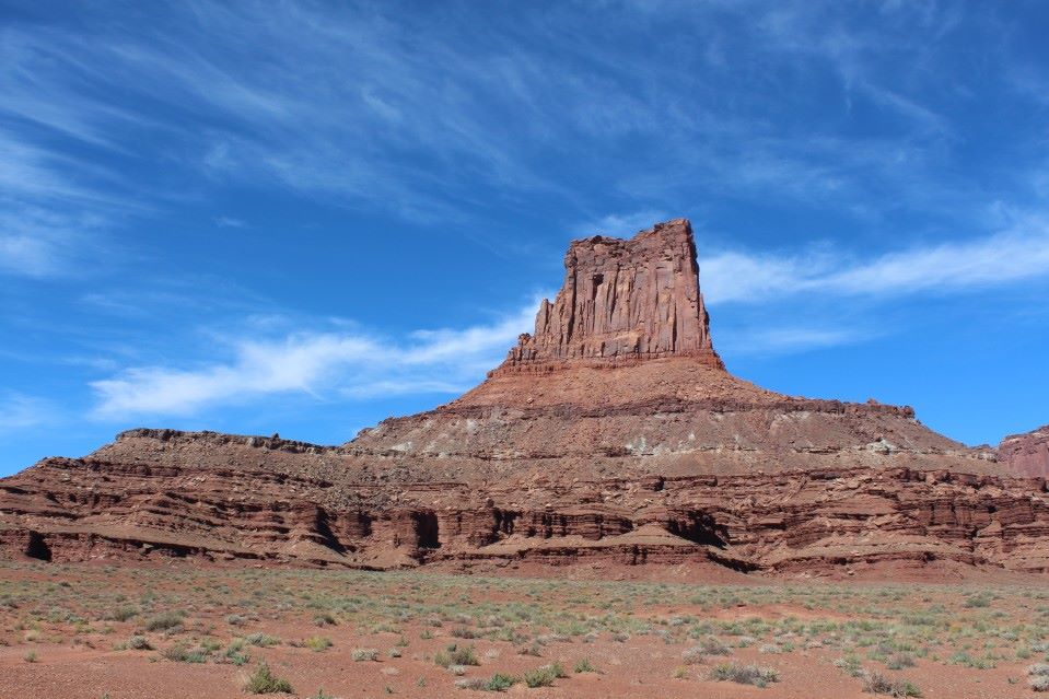
2013 trip to Colorado, Arizona and Utah
First, the pre-planning: I’ve been wanting to do this for years, since I saw a thread over on NAXJA about a guy from the midwest doing a long trip through parts of the southwest. Then, he moved to Grand Junction, CO and started posting photos every weekend about the trails he had wheeled and hiked. Talk about envy… It seemed that something came up to block the trip for several years- either not enough vacation time or not enough money for gas. Late in 2012, I realized that I’d be able to make the trip happen in late September of 2013 and started getting trail books and maps from Amazon. And, working overtime shifts to help with the fuel costs. 🙂 I read the descriptions for a lot of trails out there, but didn’t know enough to try and plan anything specifically.
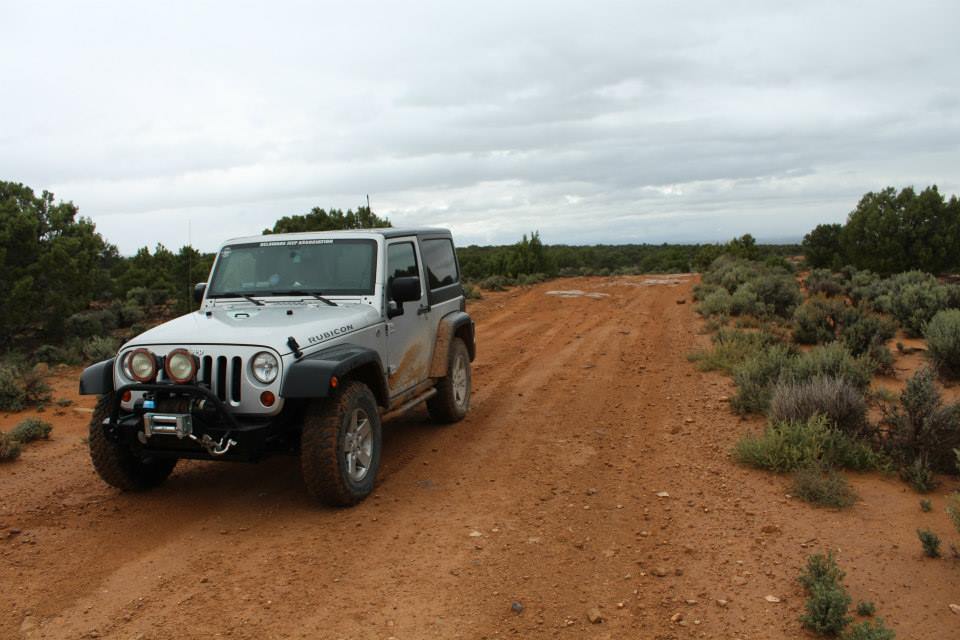
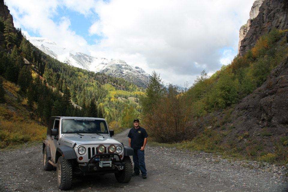
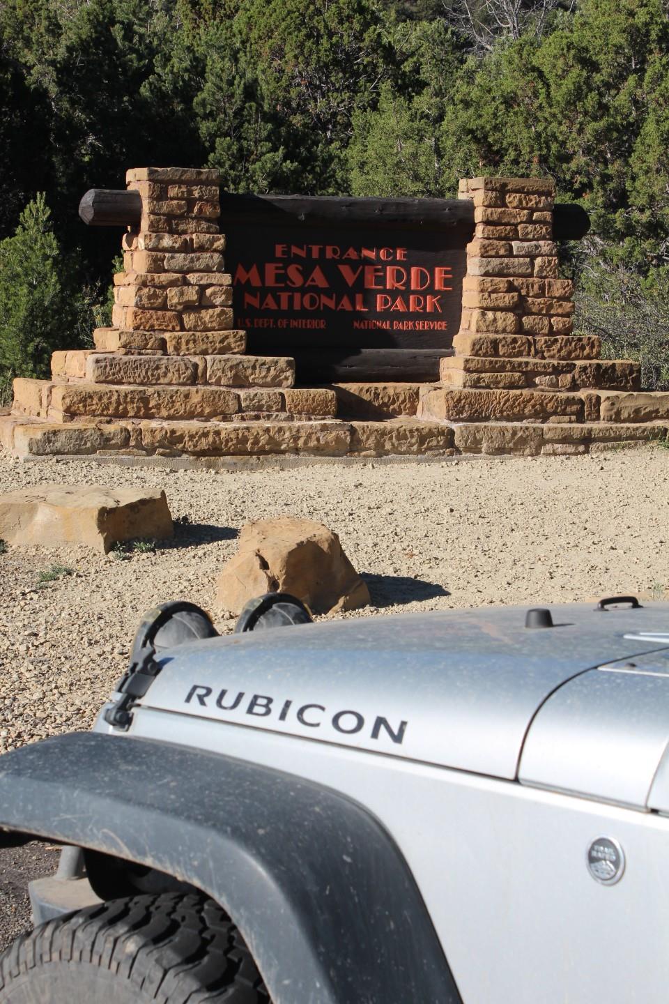
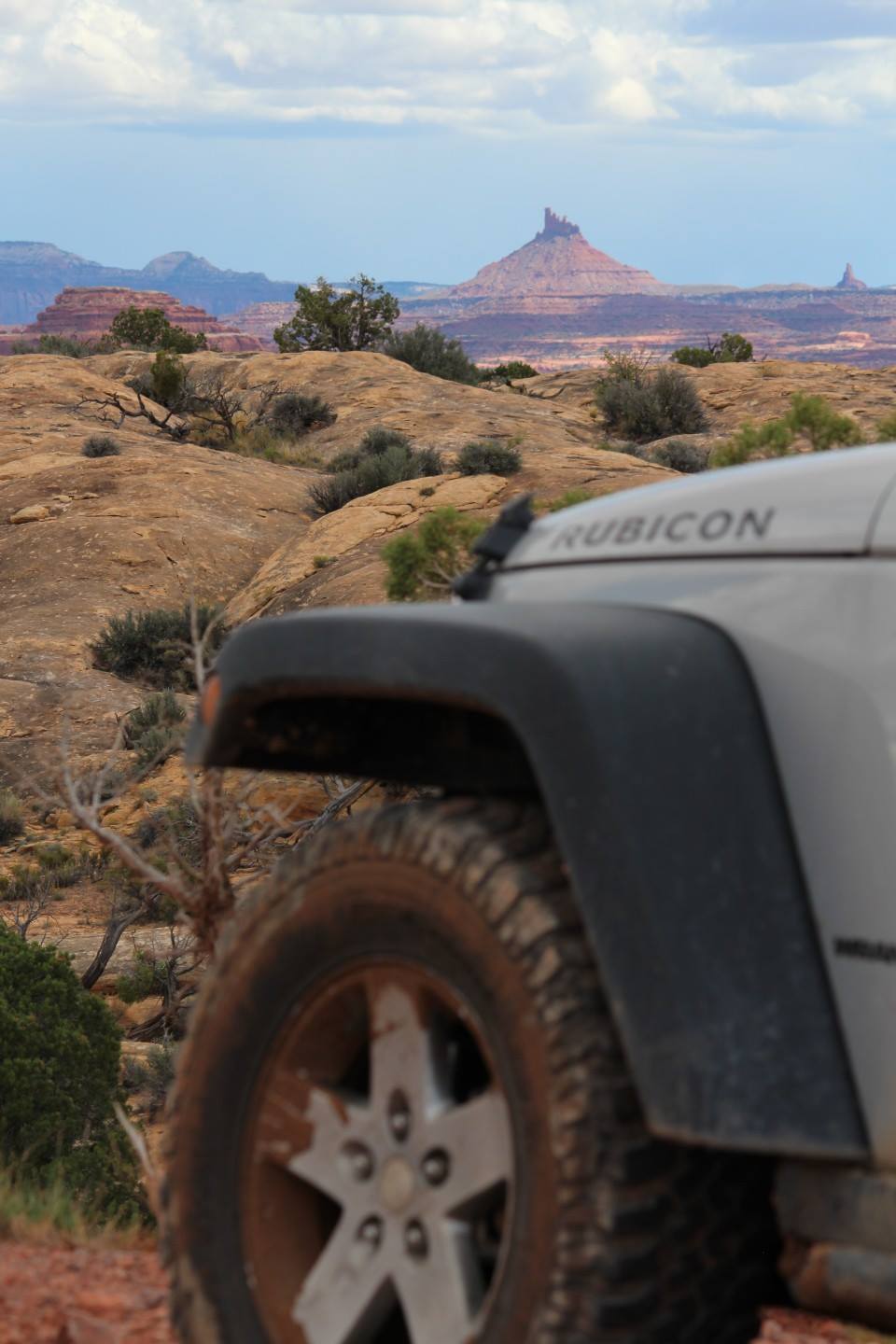
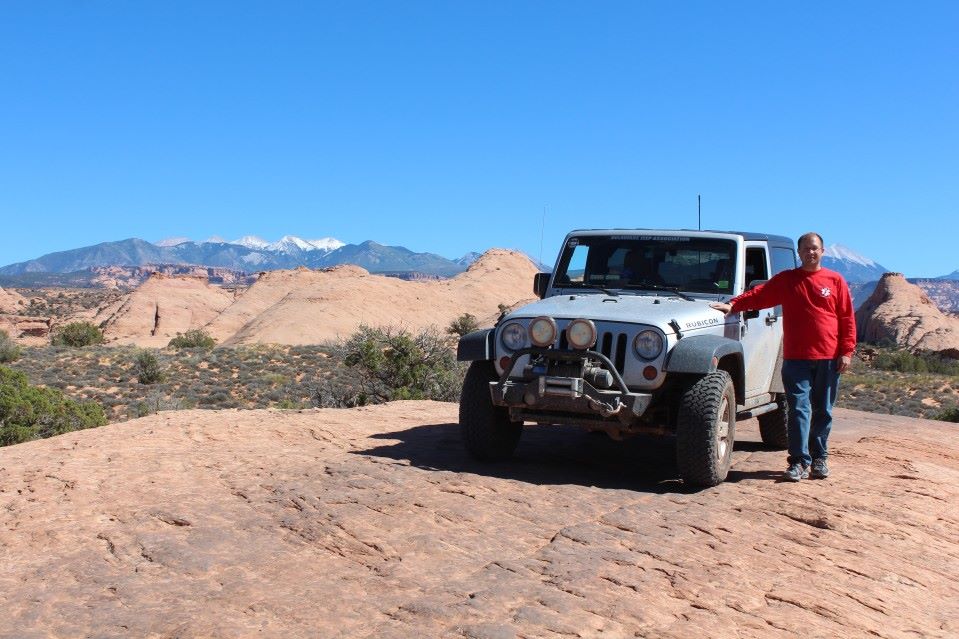
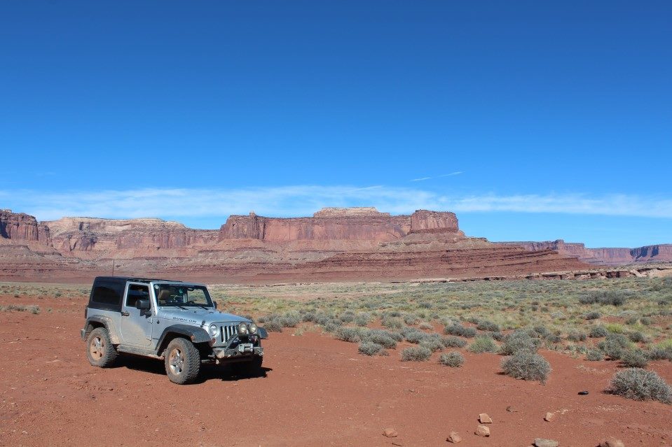
Well, as it seems to do too often, time flew that year… before I knew it, it was time to start packing the Jeep. As per my usual, I procrastinated and didn’t have time to install a budget boost I’d bought or mount an air compressor under the hood. Sigh… but, on September 19th, a Thursday evening I took a nap after work, finished packing the Jeep and started west from my home in Delaware. My vehicle was a 2012 Wrangler Rubicon, with an engine/trans skid plate, winch and front/rear flood lights. I had the usual tow straps, chains and a hilift jack inside the Jeep along with way too much food and water.
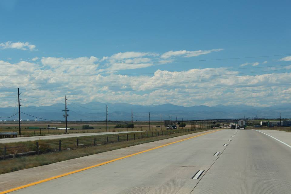
The trip out was mostly uneventful… stopping an hour or so into Ohio for a quick nap, then again in Kansas for a few hours and finally into Colorado! I drafted and played fuel-stop leap frog with two RVs with FEMA decals, I assume heading toward the flood-ravaged areas. They split off at Limon, I think. As I started nearing civilization, I saw a stranded car on the side of the road and as I passed it I could see the hood up and two people along side a car and noticed that it was a General Lee! So, I pulled over and asked if I could help out, but they had serious engine issues. Instead, I towed them a mile or so up the highway to a small town and dropped them off in front of a NAPA. They had been on their way to a charity rally run, but… I don’t think they made it. I continued up the highway and had my mind blown after I crested a hill and saw the Rocky Mountains behind Denver. Wow… words can’t really describe the feeling you get the first time you see the Rockies. Drove through the mountains (after stopping to reduce the air pressure in my spare fuel can) and made it to Grand Junction at sunset. Decided to push a little further and got a hotel room in Delta for the night.


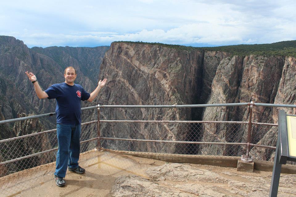
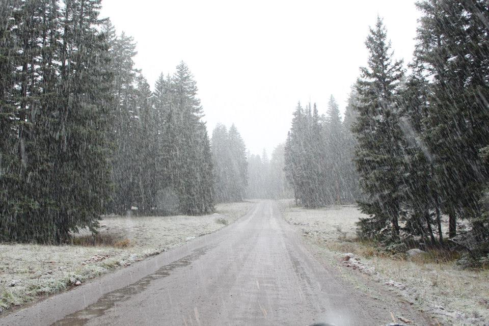
So, I made it! But, weather was pushing in and I really didn’t want to deal with setting up a tent in pouring rain the next night, so in the morning I extended my room for another night. Btw, the Delta “Sundance” Days Inn has a restaurant attached so you get a real meal in the morning instead of a “continental breakfast”, also very cool staff! I decided to play it safe and went to visit the “Black Canyon of the Gunnison National Park” for the day. The park is a few miles east of Montrose. As soon as I made it to the visitors center, it started pouring and dropping hail. Fun… it rained off and on the rest of the day. I stayed in the park until the afternoon and then decided to try running an easy trail back to the hotel. The trail was listed in one of my books as the “Uncompahgre Plateau Trail”. 90 miles long but you only need 4×4 for maybe a mile of it unless it’s wet, then maybe 10 miles. Mostly gravel forest roads, with some cool switchbacks at the north end. Started raining again, turning to snow about halfway through the trip but stopping before I got to paved roads again. Got back to the hotel and tried to plan the next day’s adventure…
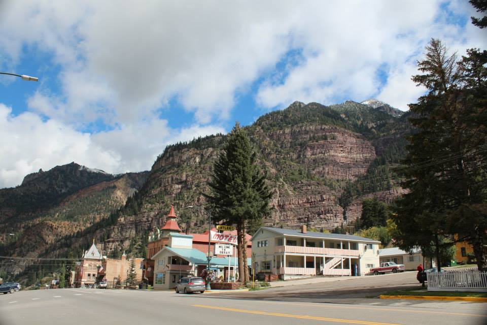
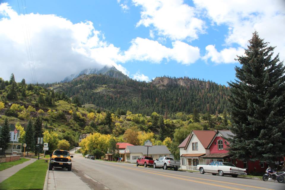
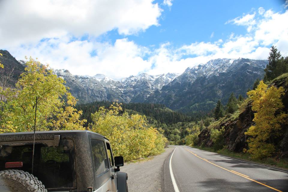
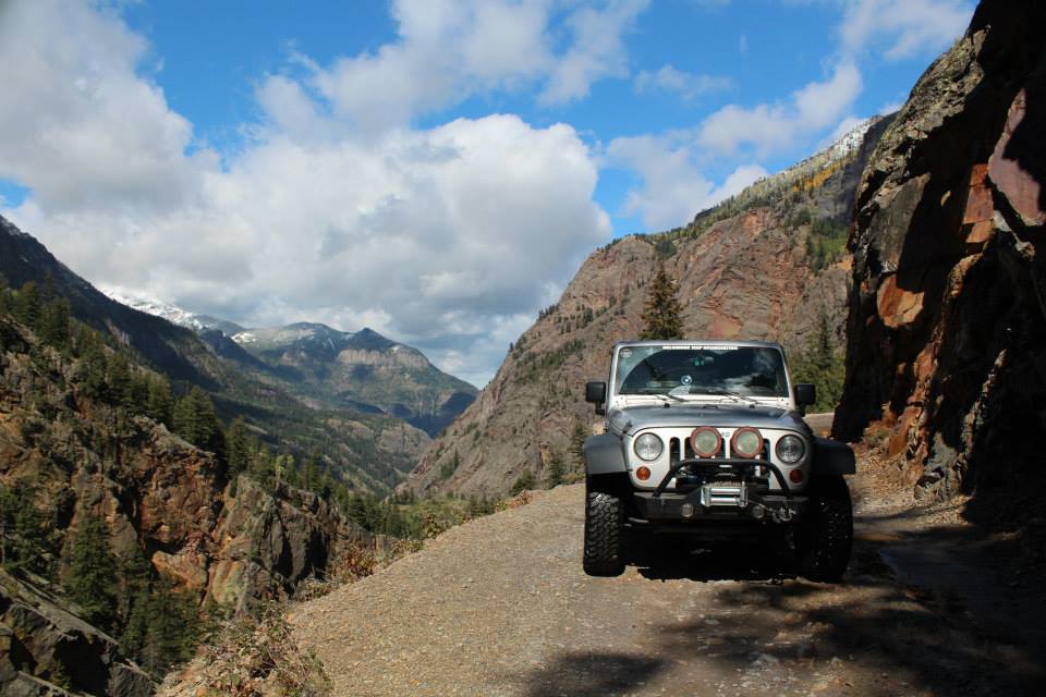
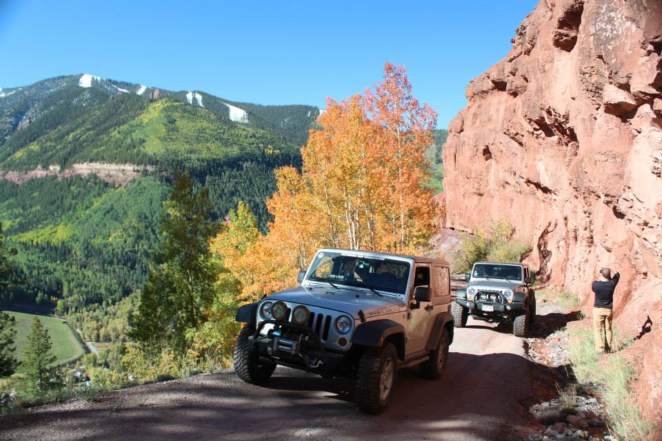
On Monday, I pack up and head south to Ouray. Very cute town, easy to see why they call it the “Switzerland of America”. Continue through town and the road starts into the “Million Dollar Highway”, a 25 mile stretch of 2-lane that is cut into the mountains to Silverton. Around half of that distance is made of switchbacks and hairpin turns. Fun, until you meet a full-size RV or fuel tanker taking up the road shoulder-shoulder in the hairpin. 🙂


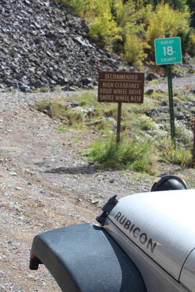
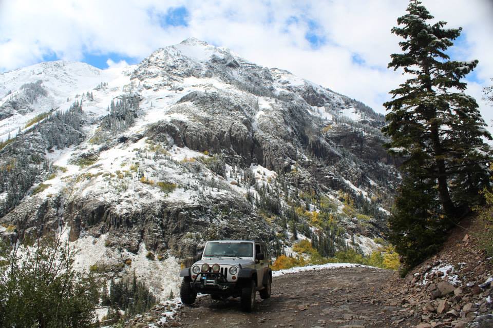
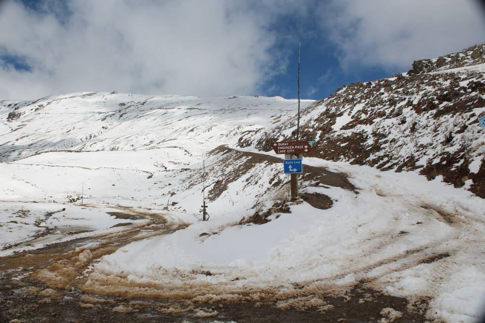
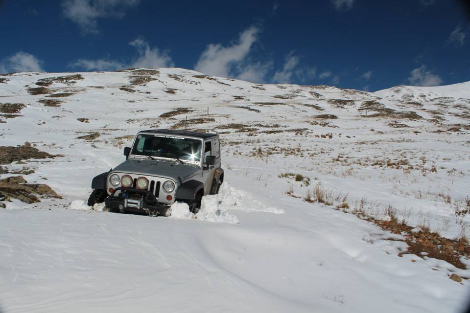
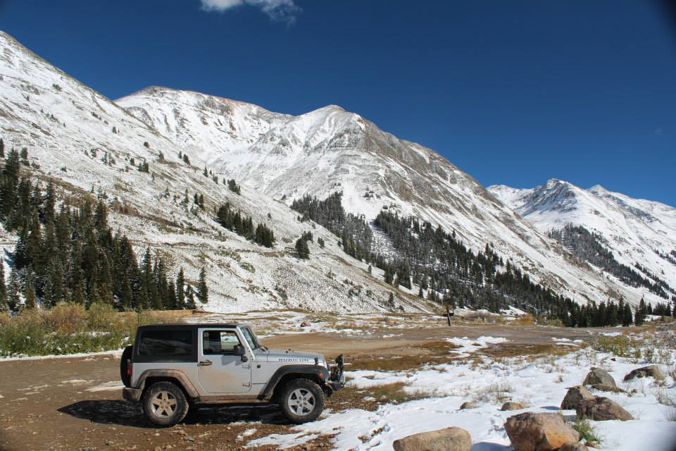
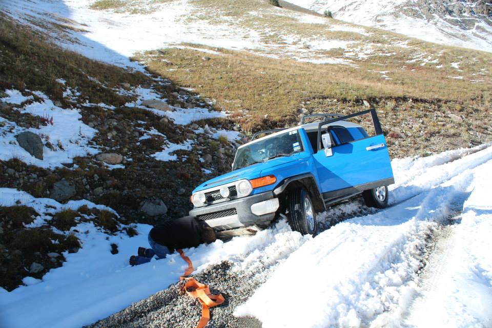
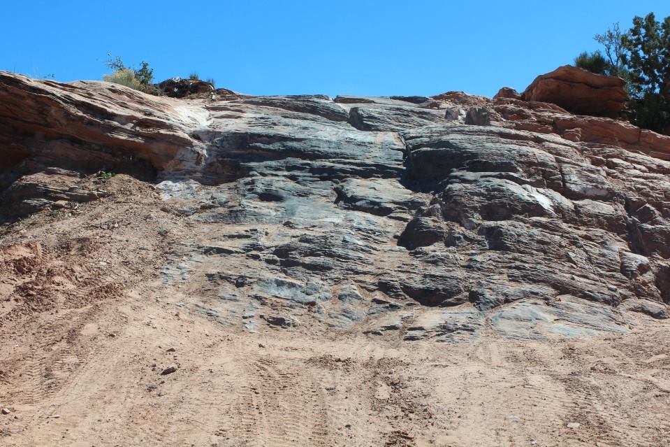
Just a few miles south of Ouray is the trailhead for Mineral Creek, an easy (for me… it’s rated a 4/10 trail) trail that gives access to the popular Poughkeepsie Gulch along with the “Alpine Loop” that I wanted to do. The Alpine Loop is made up of Engineers Pass and Cinnamon Pass. Both of which are easy (2-3/10), scenic and long (43 miles combined). Well, remember the snow I mentioned? It was only at “higher elevations”… and the Mineral Creek trail ends at those higher elevations. There was a foot of snow at the start of Engineers Pass, but there were tracks so I tried it. Got denied less than 50 feet up the hill, so I decided to try the other direction. But, first I decided to try an offshoot trail on the GPS, and a short offshoot of that which appeared to go to an old mine. I started thinking that it wasn’t smart to be driving into a small valley with all that snow, so stopped to turn around. And stopped in what turned out to be a 2ft drift. *doh* And, well above the treeline here, so had to shovel myself free. 125′ of winch cable, 58′ of straps and a 16ft chain, all useless.

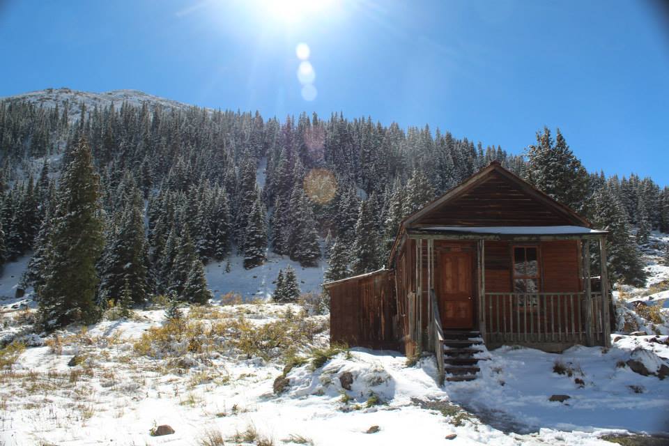
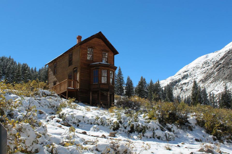
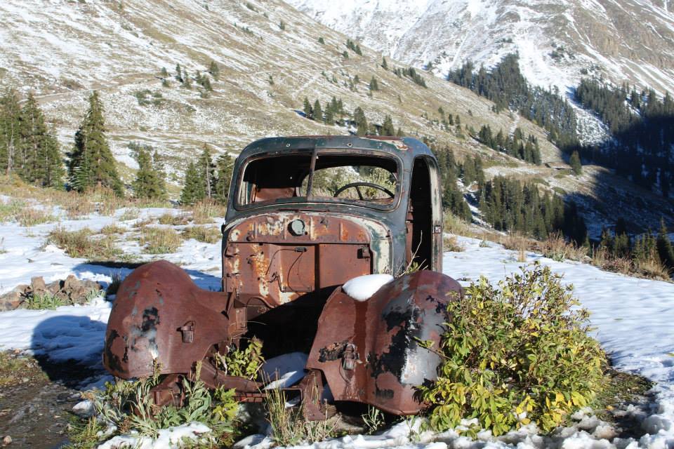
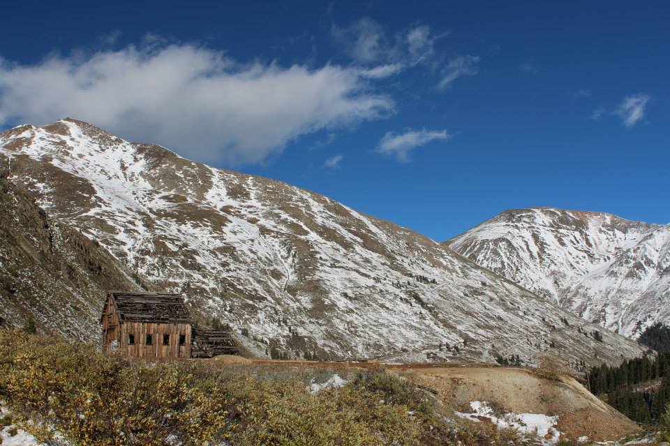
Went back to the start of Cinnamon Pass and noticed that I could see the ghost town of Animas Forks, so took a quick drive down to check it out. And passed a BMW X3 or X5 coming up to the trailhead from the ghost town (accessible from Silverton via gravel roads). Interesting… Well, spent a little time at the ghost town and returned to the trail.
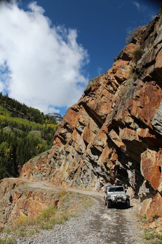
The trail starts climbing immediately and it’s mostly just a ledge trail cut into the side of the mountain with little-no room to pass. I met the aforementioned BMW about a half-mile up as they were driving/sliding down the trail, I pulled to the side and we had -just enough- room to pass. They said there was too much snow for them and they were going back to town, but thought that I’d be fine. Well, that’s encouraging, I think… I kept on going, snow ranging from nothing to a foot deep, but with a clear set of tracks from the BMW and a few side-by-sides. I was almost to the summit (12,656ft for the trail portion) when the tracks abruptly left the trail, climbed a steep embankment and went onto a plateau before rejoining the trail 100 or so feet further. Grr… They had hit a 3-4′ snow drift and couldn’t punch through it. Well, I tried valiantly (hey, it’s my story) to push through but didn’t make much progress. The snow was very thick and just compacted as I tried to push through. After several attempts, I backed up too far and got myself stuck off the trail. Out comes the shovel again… got the tires clear and was working on the diffs when a FJ Cruiser comes down the mountain following the tracks left by the side-by-sides on the dirt. They stopped just above me on the embankment and said they’d help, then asked where the best spot was to come down the steep embankment. I pointed to a spot 10 feet behind them and even though it was almost level ground with no snow but a little ice, their street tires couldn’t move them. So, they carefully made it down a trickier spot and since they had no equipment, I pulled out a chain, connected to their hitch and they pulled me free. I didn’t want to tear up the embankment more than everybody else had already done, so I turned around to lead the FJ down out of the snow. Good thing for them, since they got badly stuck around 500 feet later. I pulled them free and we made it down the rest of the way without any real issues. Now, I dunno what to do… so I look on the map and decide to try a shortcut trail back to the highways. Made it a little over a mile and met the FJ coming back down it, followed by 2 more vehicles, they had found a deep snow drift and turned around. Ok, back to the map and decide to take the gravel road to Silverton. Uneventful, but boring.
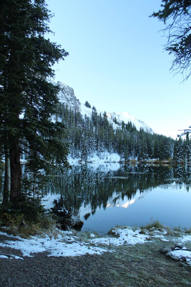
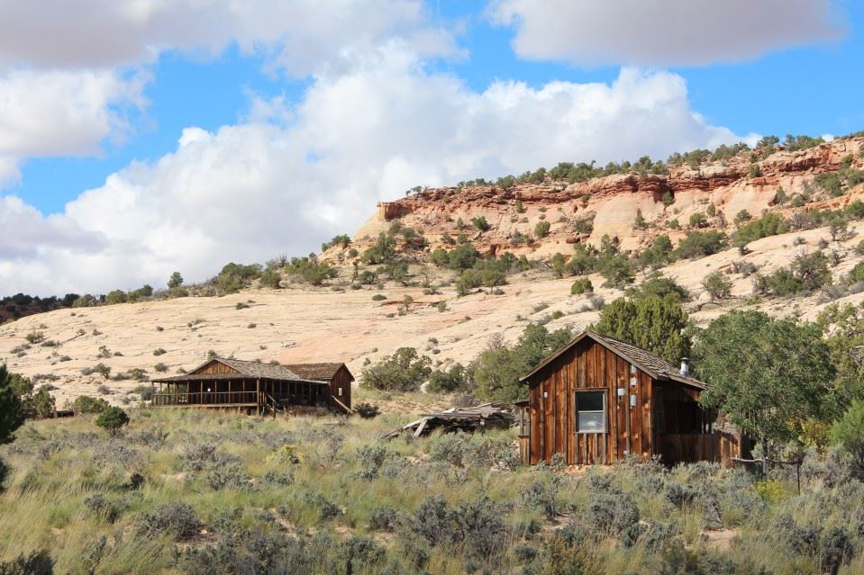
Now, to find a campsite, since my original camping plan was to be on Cinnamon Pass… Found a dispersed site at Alta Lakes, which is a former mine area (now ghost town) over the mountains south-west of Telluride. Kinda cold up there, elevation roughly 11,300 feet at my campsite. Woke up to a thick layer of frost all over my tent. BRRRR. But, it was a cool (no pun intended) experience being that high and away from light pollution. I could see inside my tent just from the starlight, and when the moon came out… it was bright enough to read. I don’t think the temperature got above 26* all night.


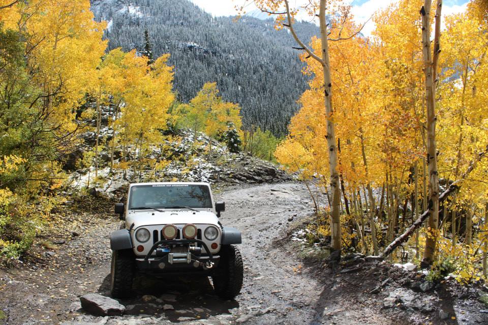
Well, I packed up around sunrise and drove to Telluride to meet a guy from JeepForum, with the intention of running the very popular Imogene and Black Bear Passes. The trail for Imogene Pass starts in town, you go on a residential street until it turns into the trail up the mountain. It promised to be a great day, the temperature was mild, sky was clear and sunny and the leaves in the Aspens were turning color.


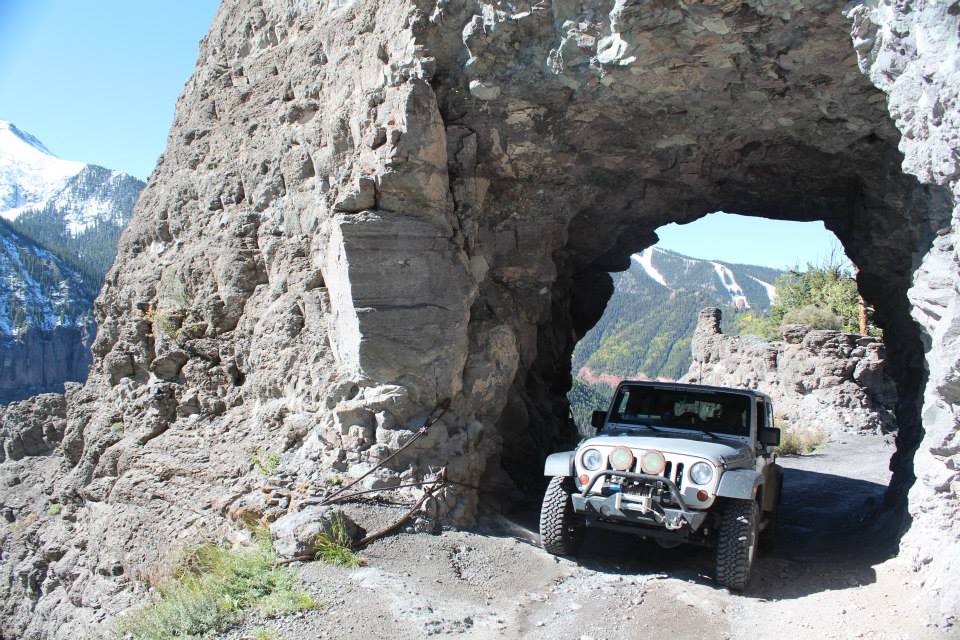
We took our time going up the mountain, stopping occasionally for photos and passed a couple vehicles coming down. We met a few vehicles at a photo spot for an old mine and they told us that the trail was impassable further up the mountain. Sigh… a 4×4 tour pickup was coming down and they told us the same thing. Bummer. We went up as far as we could (Tomboy mine) before heading back down. We had been told in town conflicting information about the trails, but the negative information was correct. 🙁 So, with the good trails closed for snow, we aired up at the gas station just outside of town (free air from a real compressor + large tank) and went out to run a scenic road called Last Dollar Road. It’s a gravel road with a few puddles and slick muddy sections that goes through very scenic ranch land and is a nice “shortcut” to Ouray. Once we got back to Ouray, I played tourist shopping for postcards and we split up.


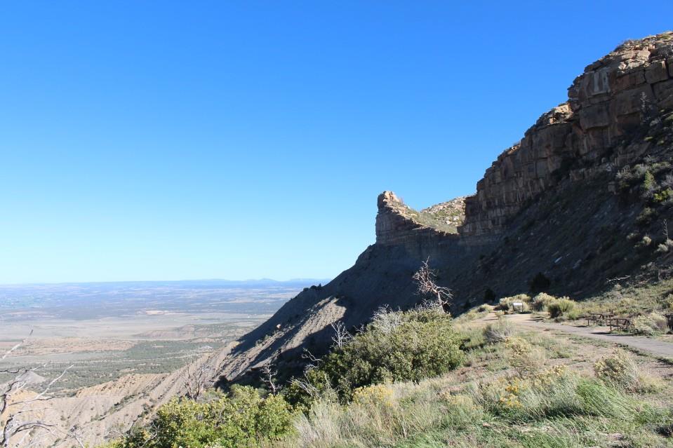
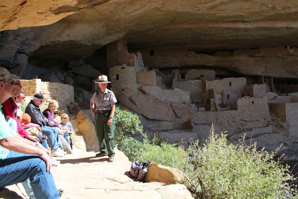
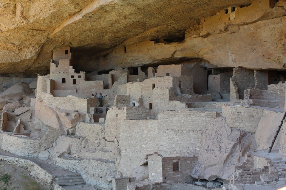
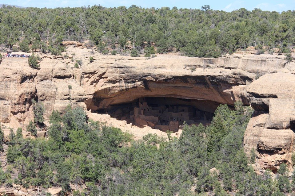
I drove down the Million Dollar Highway/US 550 to Durango then took US 160 over to the town of Cortez and got a hotel room for the night. Ahh, a hot shower and a warm bed… The Mesa Verde National Park is nearby and that’s the plan for Wednesday. The Mesa Verde NP is a little strange in that the visitor center is before the entrance gate, and all of the attractions are 20+ miles further into the park. I got a ticket for a 1 hour tour to the “Cliff Palace” which was around 23 miles from the visitors center. Pretty cool! To do it right, you could spend 2 days there and go on several tours/hikes to see the old cliff dwellings up close. Half of the park is closed in the off-season, but there’s still plenty to keep you busy for an entire day. A good zoom lens for your camera is also very useful because you can see a lot of the cliff dwellings across the canyons during the driving tour. I spotted several that weren’t listed on the overlook signs because of the lens I was using. There’s a small but pretty cool museum there that you really must visit if you go to the park. I left the park around 5pm and started west again toward the Grand Canyon.

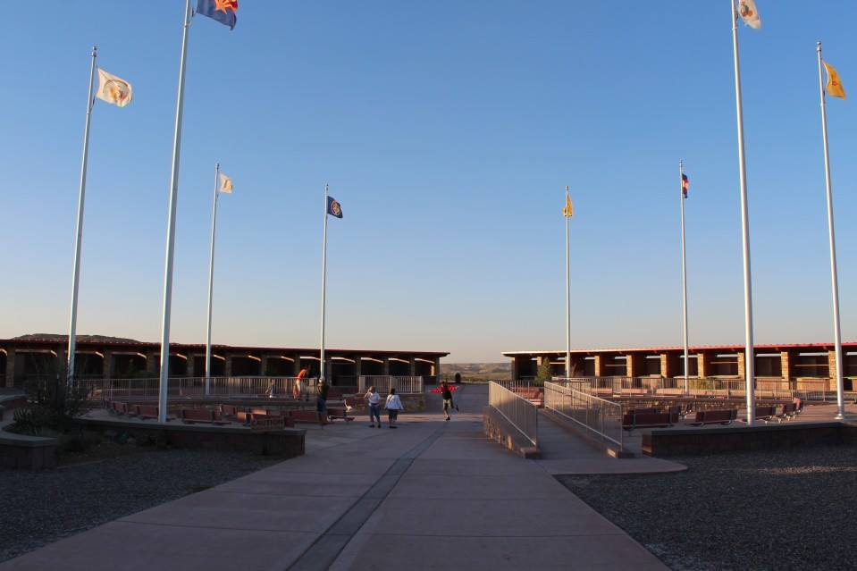
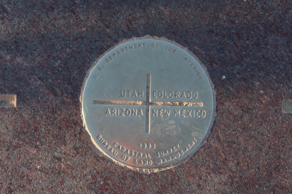
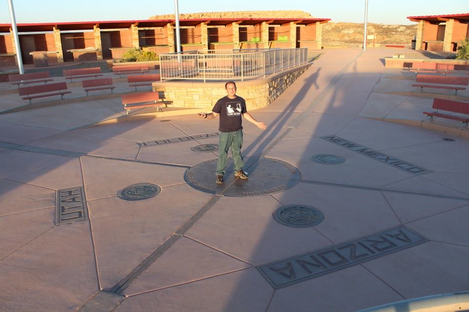
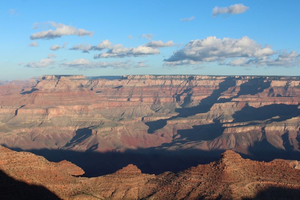
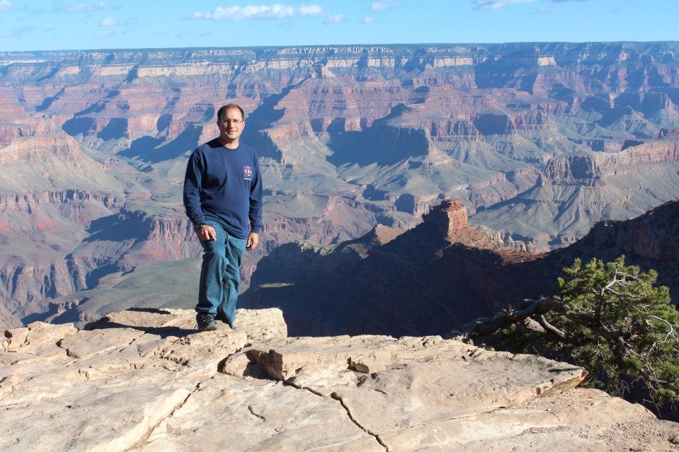
On the way to the Grand Canyon (my 3rd National Park for the trip), I made a quick stop just before sunset at the Four Corners. It’s a pretty basic spot on Navajo land. Just a gravel parking lot, and the actual monument is surrounded by booths that I assume are filled with local Indian vendors during prime tourist season. I sent up my camera and tripod for a photo and continued on… 4 hours or so later of 30-50mph cross and headwinds, I made it to the South Rim of the Grand Canyon.
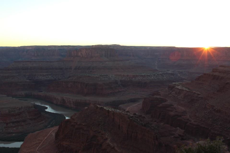
I had planned on a dispersed camping spot outside the park at the Kaibab National Forest (free!). I took a “shortcut” to the spot, which involved driving on several forest roads, even needing 4×4 for some muddy sections. I gotta mention that for forest driving at night, the HID offroad lights I have are priceless. So are the LED lights I added for backup lights. Anyhow, the spot I intended to use already had a couple vehicles there and I didn’t want to annoy them with my lights, so I found another spot nearby. But that wind… it never stopped, even in the forest! As soon as I parked, the Jeep was rocking from the wind. So, the tent never came out, it would have blown away before I could set it up. Spent the short night in the Jeep and woke up at dawn. So, I started the tourist thing at sunrise, taking photos of the canyon from the various spots and continued for several hours. A must-see detour if you’re ever in Arizona. Got bored around noon and started working my way toward the east exit and left the park around 2pm to head east/north toward Moab.
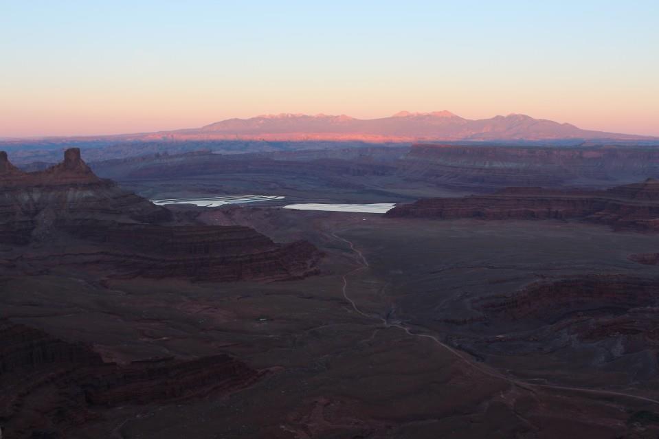

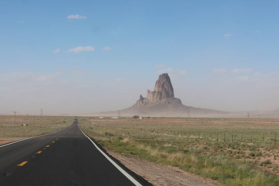
The drive toward Moab wasn’t that bad… the wind is now mostly a tailwind! Plus, because it’s still light out, I can see what I drove through last night. 🙂 The route took me east for a while, then finally north into Utah around Monument Valley and Mexican Hat. Such cool names out there… I needed to be in Moab by Friday night, so I passed by Valley of the Gods where I had originally planned to camp for the night and explore in the morning. Heading further north (and seeing rain on the radar), I decided to stop in the town of Blanding and got a room for the night. Btw, if you drive through, stop in their visitors center. It’s staffed by a very pleasant older gentleman and has a small museum with some cool local stories.


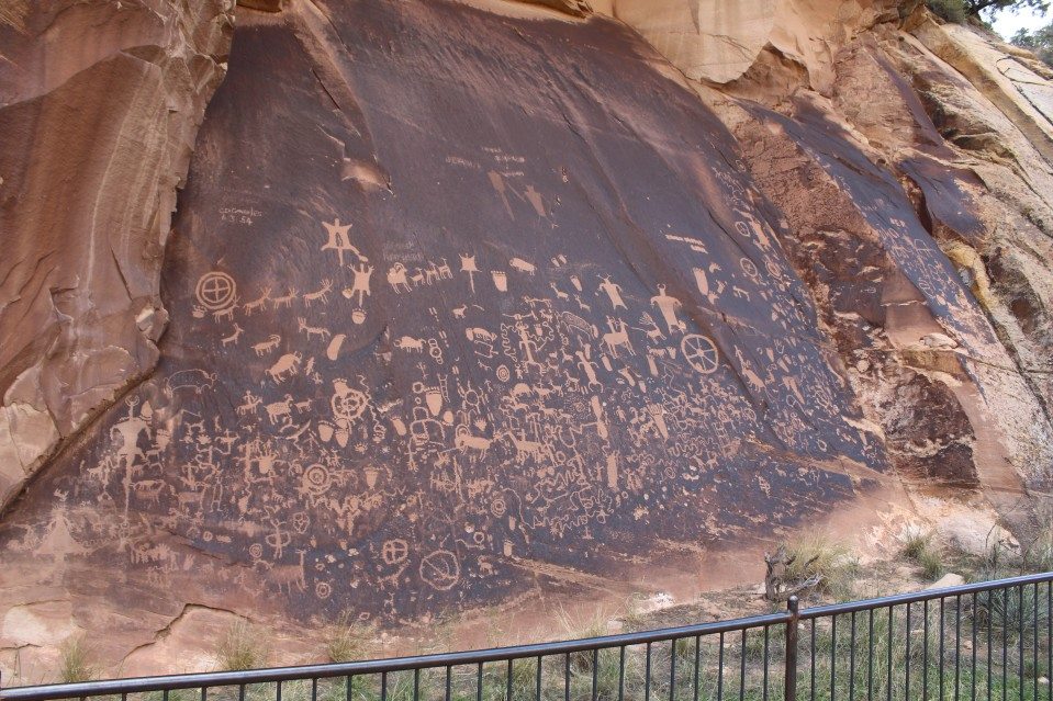
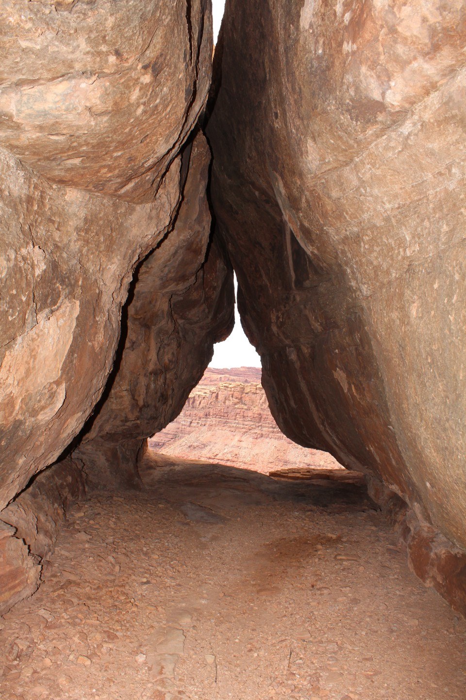
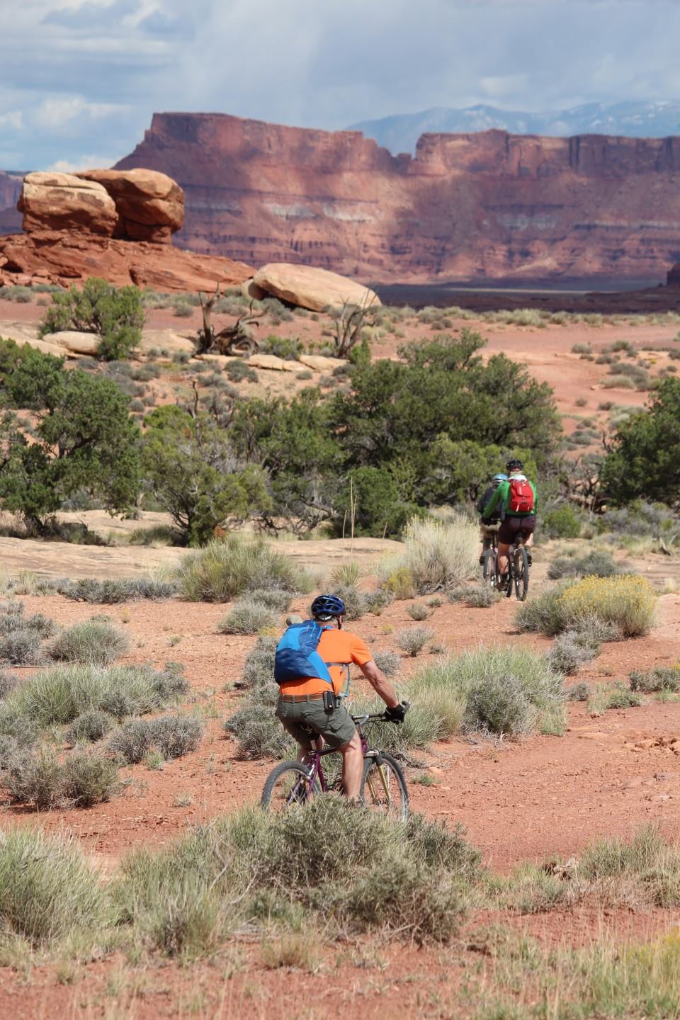
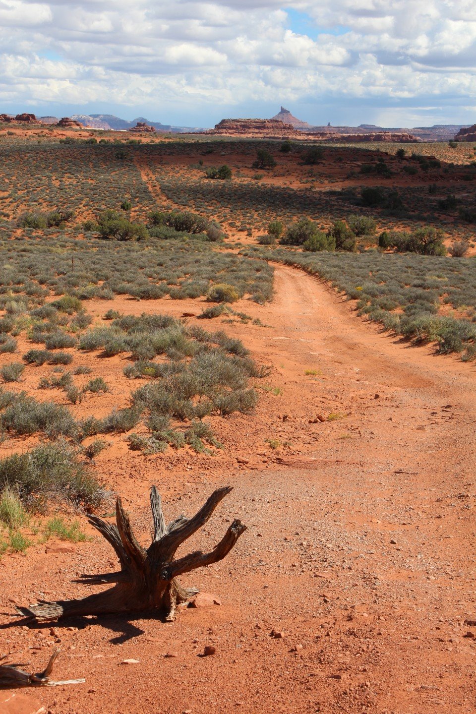
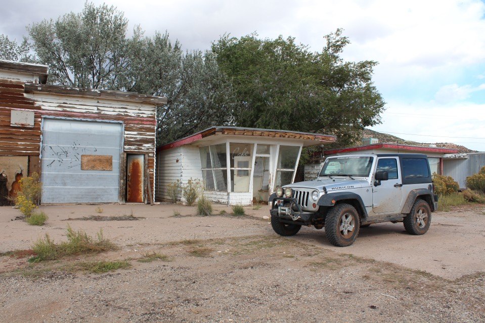
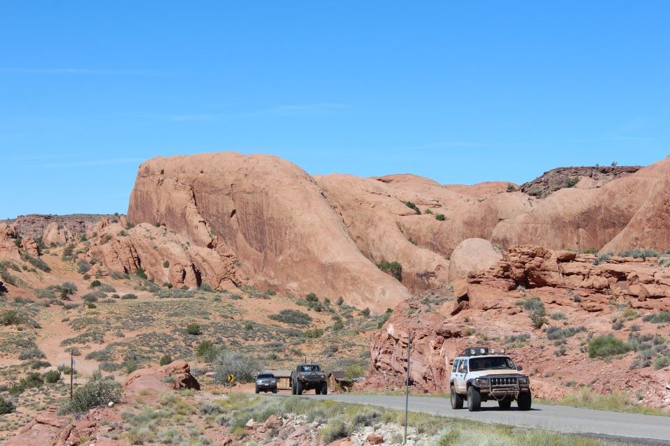
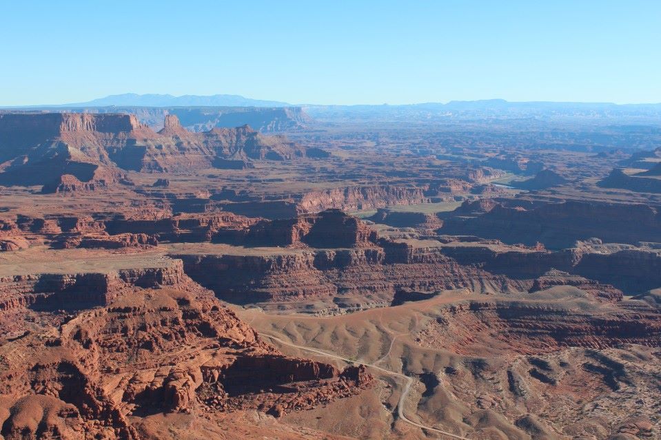
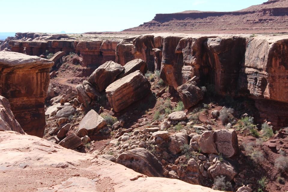
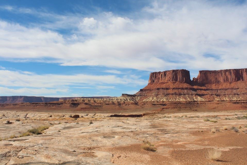
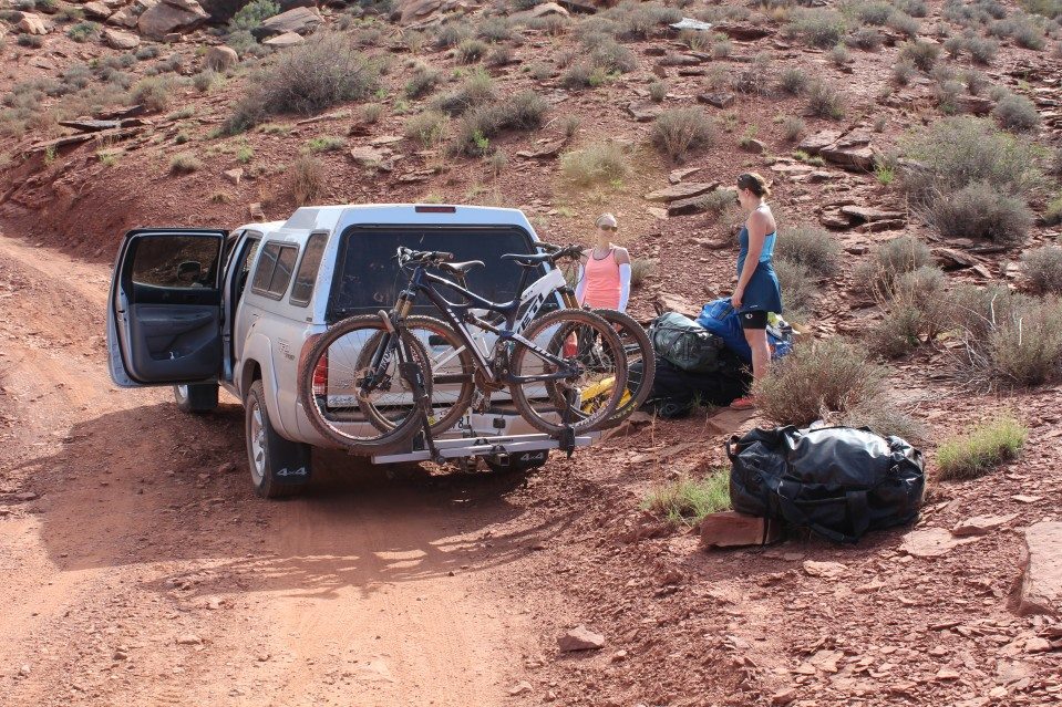
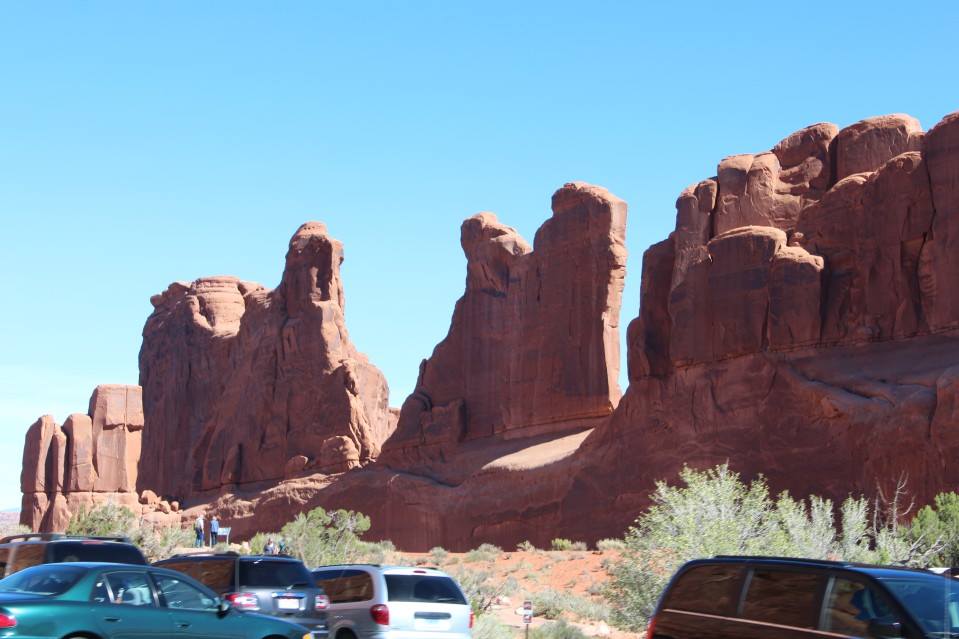
Woke up the next morning (Friday) and saw that the rain had washed off some of the Kaibab National Forest mud onto the parking lot… sorry. 😉 And started north… got gas and ice in Monticello and then took the turnoff to goto Canyonlands National Park’s Needles District. Stopped at Newspaper Rock on the way for a photo. Just before the entrance to Canyonlands I saw 2 JKs on the side of the road and stopped to see what was going on. They were tourists from eastern Europe with rentals from Moab. Rentals that had broken down… the lead JK had the front left brake caliper fall off and the front right wheel sensor was ripped out, too. And the other Jeep’s dash was dead, the wipers wouldn’t stop but the engine and trans ran fine. Apparently they went through some deep water on the Lockhart Basin Trail. They also told me that a few trails I wanted to run in the park were closed due to flood damage… They told me that a replacement Jeep was on the way from the rental company (Cliffhanger Rentals, I pity their mechanics) so I continued up to the park. There, after a stop at the visitors center, I took a 4×4 road to an overlook. This was actually in my trailbook but didn’t notice it until later. It’s rated 3-4/10 in that book, but wasn’t really that difficult and the first 4 miles was an easy dirt road. It’s 7 miles from the visitors center to the overlook… didn’t see anybody until I got there and found some mountain bikes parked at the end. Walked up to the overlook edge and found two groups of bikers sitting in the rocks having lunch. Awesome spot! I offered them water but they all had plenty. One of them told me about a cool “tunnel” in the rocks that led to a dropoff over the canyon. Found that and took a few photos then ate and let the bikers get a head-start before I left. I caught up with them a mile or two later, then passed two people walking back to the visitors center another half-mile later. Stopped to see if they needed anything and they told me that they had left their vehicle further down. I go down a bit further and see their car (a “crossover”) parked just beyond the start of the rough section. It was good that they chickened out, nowhere near enough ground clearance for what they would have run into.


Left the park and noticed that the rentals were gone (good thing, it was almost 4 hours later) and headed for Moab. I had intended to take the Lockhart Basin Trail as a shortcut to Moab but since the rentals apparently found some deep water, I didn’t want to risk it and took the paved roads back (40 extra miles but probably the same time). Stopped in Moab for gas (reasonably priced in town) and fresh lunchmeat. Side note, the Texaco station has an airhose to the left of the door. No sign about having air, but it’s free and attached to a real compressor and tank inside the building. I see on Facebook that friends of mine were already at the Dead Horse Point State Park, so I left town to go meet them. This is just outside the entrance for the Canyonlands National Park’s Islands in the Sky district, both of which are around 18 miles from the highway to their entrances. I get to their camper at sunset as rain and sleet are falling. My plan was to set up the tent behind their camper, but they had an extra bed so I ended up staying there for the next 2 nights (they had heat!).
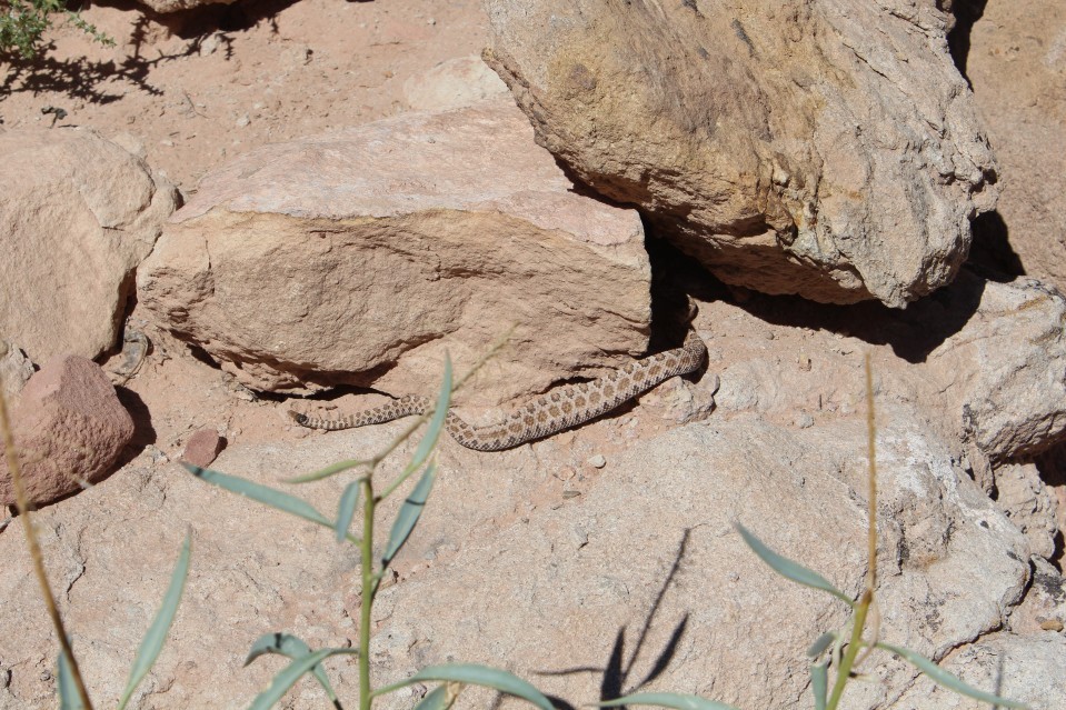
Saturday, we all leave the park and go to a spot in a guidebook I had that mentioned a short hike with dinosaur bones. Cool! We get out there, and had to use a little 4×4 to get there due to soft sand in a wash. I noticed a few designated campsites along the way on BLM land, too. Got to the trailhead and started the hike. They have signs out telling you where to look for the dino remains which makes it easier. After the second sign, I head a rattle and looked over to see a baby rattlesnake moving behind a rock and hissing. COOL! Only the second time my friend has ever seen rattlesnake in the wild and my first time. We keep an extra sharp eye out now (she’s a nurse, they’re both retired military and I’m an EMT), but no more snakes are to be found. We finish up the walking tour and split up after we get back to the vehicles.
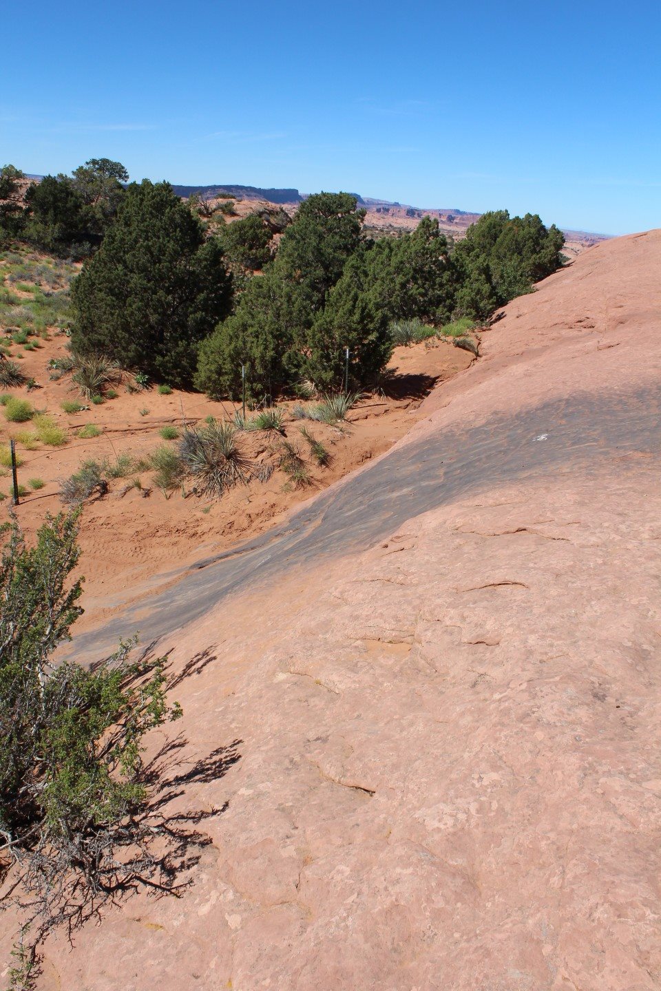
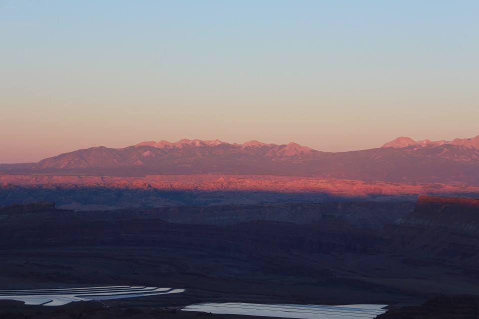
They’re in a Chrysler Aspen and I want to hit the 4×4 trails, so we split up… I drive back towards town and go through town to the Sand Flats Recreation Area (home of Hells Revenge and Fins and Things) to run Fins and Things. I see Lions Back on the drive in (closed for several years…) and stop for a photo. Get into the park and take note of the tons of campsites… popular place. The trailhead for Fins and Things is actually in the middle of a group of campsites and easy to miss if you’re not paying attention. Get onto the trail and realize that this isn’t that difficult either, but it’s rated 4-5/10. Very dangerous, but not that challenging compared to the trails I run back home. The hard spots are the descents off of the various fins. Usually very steep but there are spots that a stock 2-door Jeep can do. But, the descents are difficult for vehicles with poor departure angles. I had to rescue a 4Runner that was suspended by his hitch on a descent. I did one of the optional loops for a little extra challenge. 🙂 I scraped one of the skids a little on that and I didn’t air down, so might have been not that easy for a stock Jeep that had aired down. I finish up the trail in the mid-afternoon and head back. Stop and stare at the start of Hells Revenge for a minute, trying to talk myself into doing it, but ultimately decided that I didn’t have time to finish it before dark. Went back into town to gas up (a daily occurrence) and went back to Dead Horse Point State Park. There, I drove out to the namesake of the park for a few photos and back to the friends camper for dinner, then back to the point for sunset photos (I’ve never been very good with those, sorry).
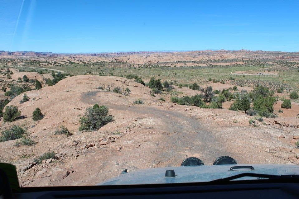
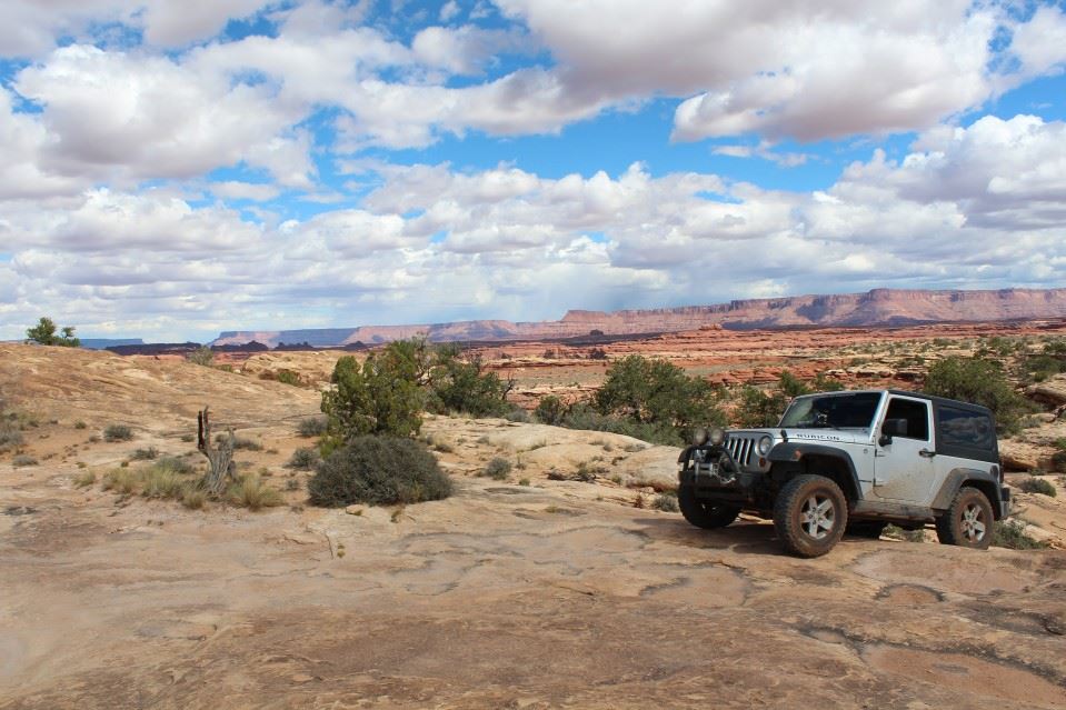
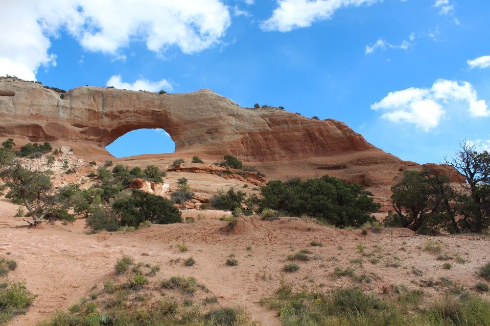
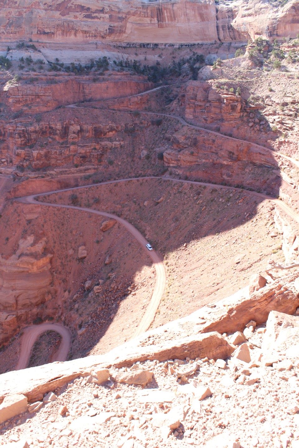
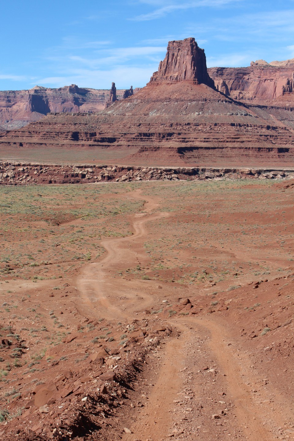
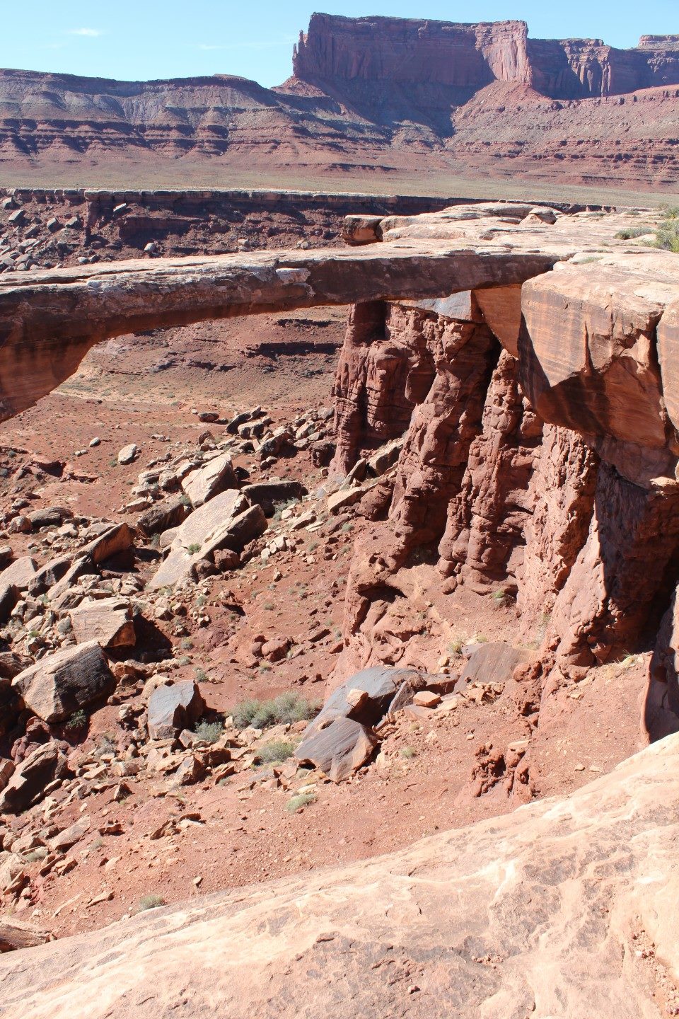
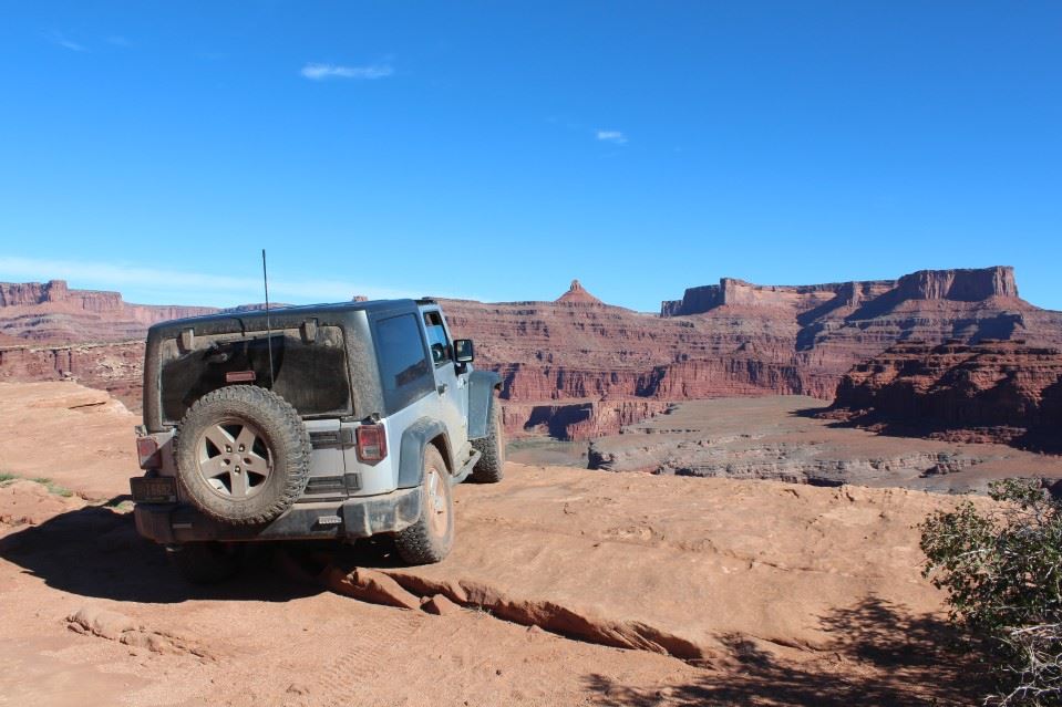
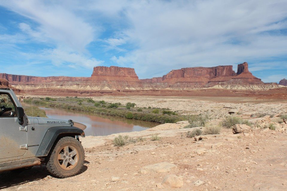
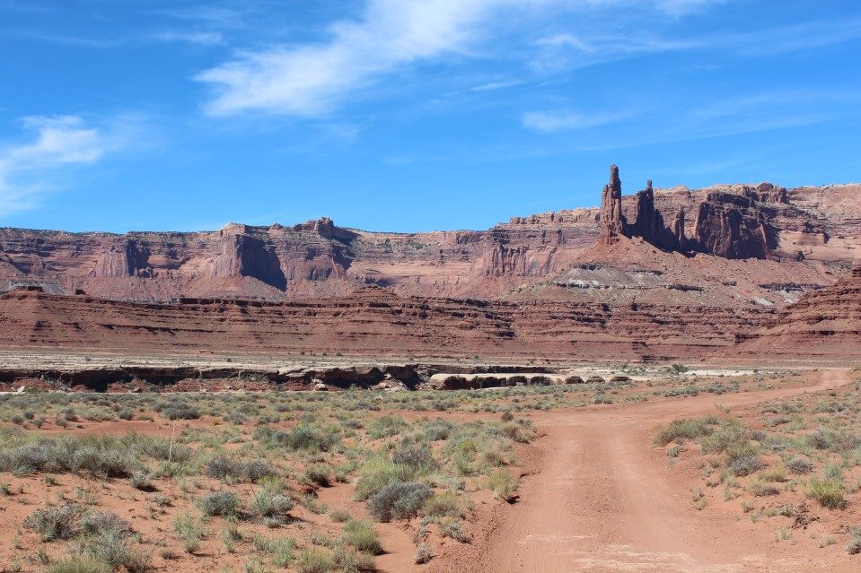
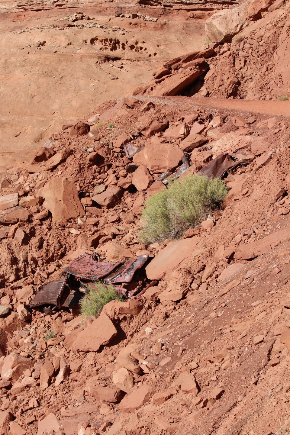
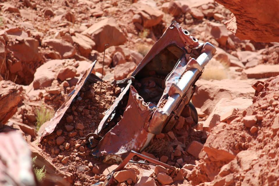
Sunday, we split up again… my friends are going to pack up and start home and I want to run more trails. There is a long 100-ish mile trail (White Rim) inside Canyonlands NP that runs through the canyons and along the rims. Usually recommended to be done in 2 days with camping, but the campsites must be reserved in advance so I will just power through. It starts off with an awesome set of switchbacks to get you down to the canyon base, where I aired down for comfort and took off the hardtop front panels. Then, started driving! Moved as fast as I could for most of it, but some of it was really really rough. Not much traffic the entire day, passed maybe 6 vehicles going the other direction and 10 mountain bikes. 2 of the vehicles were support for the bikers. A lot of amazing views there, letting you get really close to arches. I wasn’t brave enough to walk on it (Mussellman Arch) since you can see rock far below you that had once been attached to the arch. There are several designated campsites with vault toilets nearby spread out along the trail. Two of them had exceptional views from the campsites. There were also a few hikes you could do (one took you near Indian ruins) and an optional 10 mile offshoot road that I didn’t run due to time. In future visit, this would definitely be a 2 day trail. The trail has many direction changes, switchbacks and hairpin turns. That combined with the normal winds and dusty roads, I got a lot of dust in the Jeep that day… lol The route I took ends the trail in an area that has frequent rockslides… but fortunately it was clear. Now, you’re still 10 miles from the nearest paved road. One section of the non-trail portion is switchbacks and I noticed at the base that there was something metal halfway up the hillside. Grab the zoom lens and it seemed to be an old vehicle. Made a note where it was and looked down from the road when I got further up. Found remains of 3-4 old cars. Interesting! Sadly, the park was closed by the time I got back to pavement, so I couldn’t ask about the story behind the vehicles.

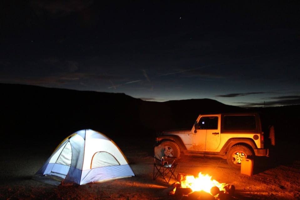
Back on pavement, I took my time heading back to the area where the dinosaur trail was… taking my time because I didn’t want to air the tires back up yet. I find a large parking lot that’s actually a few group campsites and take the best spot for myself. Farthest from the road, elevated and it’ll be the first spot to get the morning sun. Amazingly, it’s still an hour before sunset, so I start setting up the tent and such. Tent goes up much easier than in the sub-freezing temperatures I had in Colorado (currently around 70 here) and I set up the table, chair and propane stove. Cook up some hotdogs, start a fire in the firepit and relax… now, I get really comfy and hook up the laptop to the inverter in the Jeep and tether it to my phone (also the first spot I’ve camped at that has had cell reception!) to surf facebook and watch a show I’ve had saved on the laptop. It’s around sunset now so I take a few photos before watching the show… after the show ends I try for a few photos of stars and crawl into the tent. Get a great nights sleep, woke up a little after sunrise on Monday. Looking back, somebody with a trailer-mounted tent was across the parking lot, but they didn’t set up until after dark.
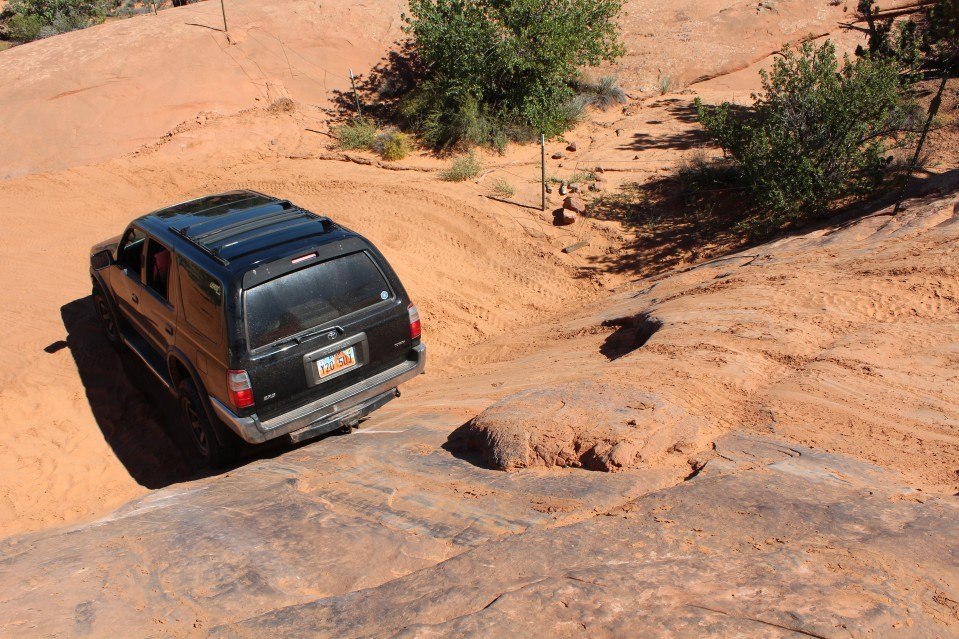
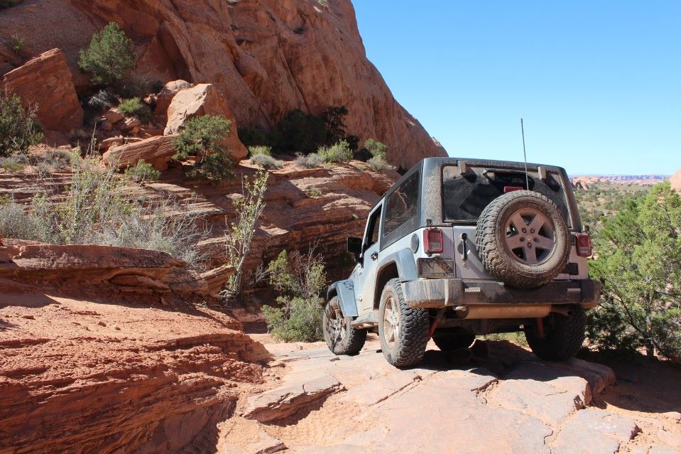
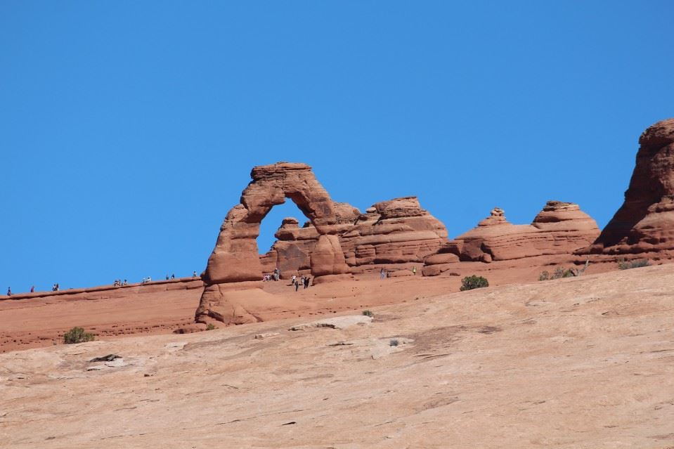
Monday, I take my time getting on the road. Eat, pack up the tent and such… then drive to town to air up (too lazy to dig the compressor out of the Jeep) and refuel. Then a quick trip outside town to Arches National Park where I do the driving tour, then try to take a dirt road to a 4×4 road for a short hike to one of the more remote arches. Well, the 4×4 road is actually pretty tough. Harder than Fins and Things, actually! Took me a while to get through it and I was on a time crunch so I abandoned the hike idea and took an alternate 4×4 road out. This one is much easier, and has some fast fun sections in a wash. Pulled over to let another Jeep go through and they asked me how the trail was behind me. I warned them about the hard section but they said that they didn’t want to go back through what they’d already come through. That had me laughing later, as this trail is much easier than the trail I had come through. The main trail is doable for a pickup truck, while I wouldn’t want to do the harder trail with anything less than a 2-door Jeep with 32s. After finishing this 4×4 road, I took another 4×4 road out to the highway as a shortcut. Bumpy bumpy bumpy… Not difficult, just rough like most of the easier trails out there are. Probably a lot easier if you air down…

(expo rig! decal on the roof says http://aventuren4x4.com/ )
Now, I take the highway north/west to my friends home in Heber City. After this, my trail exploration is over… I stayed two nights out there, did some touristy stuff and went on a gravel road with one of my friends in her lifted JKU. Then, headed home via I-80 to I-74 to I-70. Next time.. I need to lift the Jeep, move the gas can out of the Jeep onto a bracket, go 2-3 weeks earlier and use smaller totes to pack. Plus, I can buy food in Moab so I don’t need to carry it all out with me. I left on a Thursday night and got home 2 weeks later on a Friday afternoon. For 507 photos from the trip… https://www.facebook.com/media/set/?…1&l=bba910abda They’re not all in order, but most are. A lot of great photos, even if I do say so myself.
Epilogue: Wow, what an experience… even with a mostly-stock Jeep and an $80 tent from Amazon. After that trip, I installed a 2.5″ lift kit under the Jeep and 255/80/17 tires. Same width as the factory mud tires, but an inch or so taller. I also upgraded to LED headlights, mounted the air compressor with a tank, added a rear tire carrier with room for two 5gal gerry cans and the hi-lift jack, along with a Kenwood ham radio with an APRS tracker so friends at home could follow my adventures on Google Maps. I went back for another trip in 2014 with a passenger from my local Jeep club. That story will come later. After that trip, I started planning how to make it a little easier and I’m currently building a fiberglass M416 trailer from Dinoot with a custom frame. Hoping to add an OzTrail tent before my trip this fall. -April 2015